
Lincoln Park Neighbors on a Block
Public sources answer different questions about Lincoln Park neighbors. The Wayne map explains which parcels touch or face one another. Lincoln Park BS&A gives current property fields for a selected parcel. A deed can show a recorded transfer. A voter file has its own state-law access route, and historical directories can place a head of household at an address in a particular year. Treat those as separate clues. An owner name, for example, is not automatically the name of the person currently living there.
| Source | What it shows about a block | Access |
|---|---|---|
| Wayne GIS parcel viewer | Parcel boundaries, address points, roads, district/environmental layers, clickable neighbors | Free public map; dynamic; verify owners in city assessor |
| Lincoln Park BS&A | Owner/taxpayer, mailing/situs, values, building and sale/property fields | Free public portal; no household roster |
| Wayne deed index | Recorded transfers and liens for each parcel | Name index free; expanded/image access paid; older counter/mail |
| City building/BS&A | Permit, inspection, code/enforcement history at address | Online/counter/FOIA; fields/years vary |
| Voter record/list | Registered names/addresses at lawful jurisdiction level | Personal MVIC; FOIA/list request at cost; sensitive/protected fields removed |
| City Neighborhood Watch | Civic safety participation/contact route | Join through program; no public member list located |
| City community organizations | Public organization names and contacts | Official city page/resource guide |
| Library directories | Historical head-of-household, address, phone, occupancy marker and moves | On-site/licensed collection; years/gaps apply |
| Chamber directory | Businesses, categories and business contact | Public member/business search; not household data |
Start with the address, not a person’s name. That makes it easier to see both sides of the street, identify a corner lot, and distinguish a parcel from nearby roads, alleys, park space, or rights-of-way. It also makes the limits clearer when a parcel is a multi-unit property or carries a taxpayer address elsewhere.
Mapping Lincoln Park Neighbors
The Wayne County Parcel Map is the geographic starting point for a block. County descriptions identify a Find Address, Tax Parcel, or Road search, parcel and address selection, zooming and panning, plus layers for roads, boundaries, polling places, school districts, voting districts, zoning, and environmental features. The current map is dynamic, so its exact menu and analysis controls should be checked in the live viewer.
Begin by finding the target address or parcel. Turn on parcel and address layers, then inspect the adjacent polygons along the same frontage and those across the road. A parcel boundary demonstrates land adjacency, not a personal connection. A map popup can provide a parcel or address reference, but Wayne County says current assessment and tax information is prepared by local communities. Confirm every current owner or value in Lincoln Park BS&A.
Note: GIS layers explain block geography and civic boundaries, but they do not identify a household or replace the city’s assessment record.
Lincoln Park Parcel Cross Checks
Lincoln Park’s property gateway directs users to BS&A for Assessing, Building Department, Current Tax, Property Sale, and Utility Billing areas. Search by owner name, property address, or parcel number. Property detail may include the owner or taxpayer, situs and mailing addresses, parcel or account number, legal description, sale history, land and building summaries, assessment values, and related department tabs. Fields can vary by parcel, and the city advises users to verify data with the assessor.
A useful block note records three fields separately: the situs address, the physical location of the land; the mailing address, where the tax mail goes; and the parcel ID, a stable land identifier. The property result can make a neighbor-by-address question more precise, but it cannot establish that an owner is a current occupant. Where the land history matters, the Wayne Register of Deeds offers a free grantor/grantee name index, with expanded fields and document images through paid access. Its public web service begins January 1, 1960; older research belongs with the office or a detailed mail request.
Open the Lincoln Park BS&A property search to see the city’s property gateway.
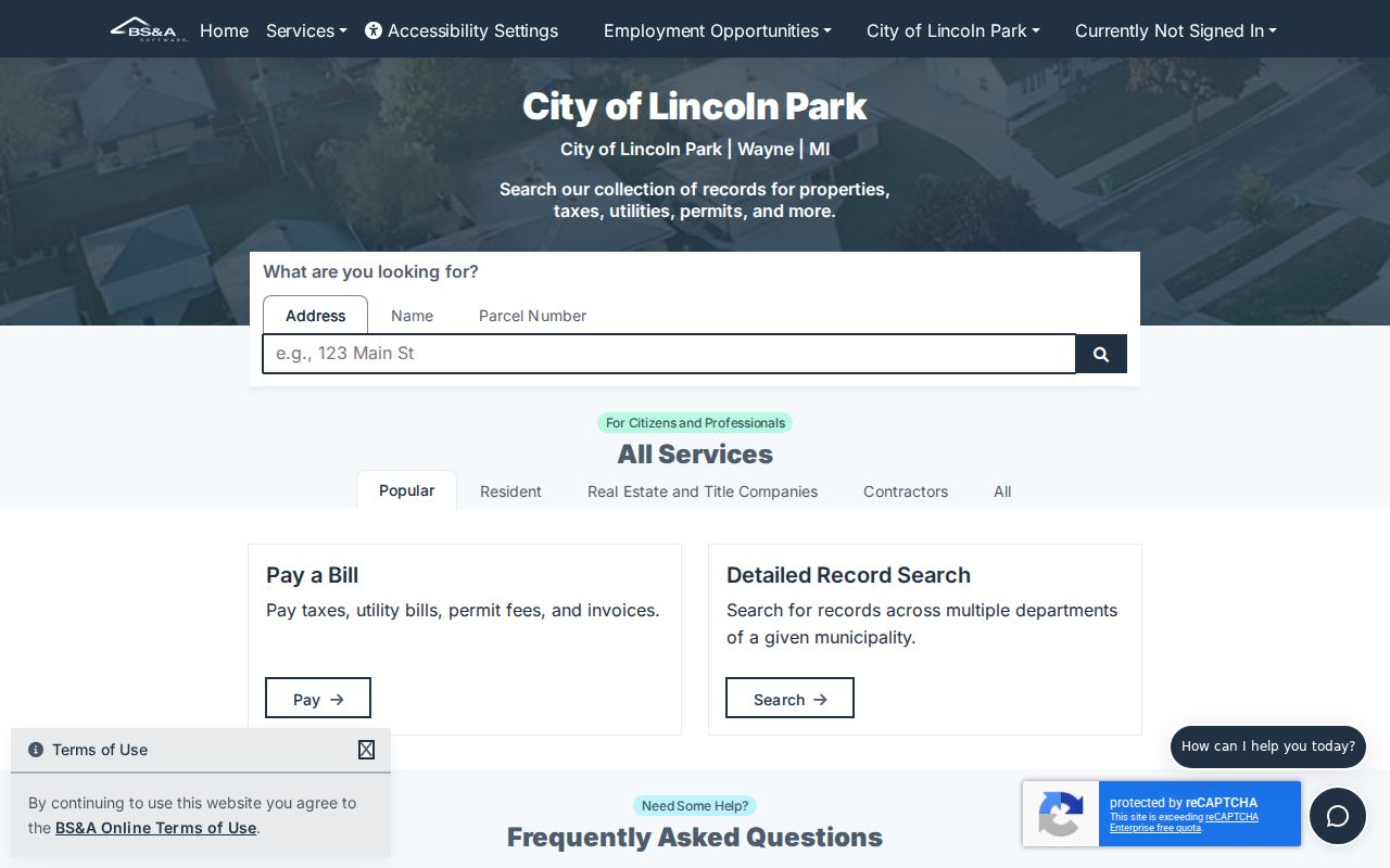
The assessor gateway is the local verification point after the GIS map has identified nearby parcel references.
Lincoln Park Neighbor Verification Flow
Use a repeatable block method instead of assuming a map label is complete. The sequence keeps a target parcel, each adjacent parcel, and the city-level confirmation tied together. It also avoids turning a land record into an unsupported claim about a household.
- Locate the target address in the Wayne GIS map and save its parcel ID and situs address.
- Click the parcels touching the frontage, the next parcels along the road, and the parcels across the road. Note corner lots, alleys, parks, drainage, and rights-of-way.
- Open each parcel in Lincoln Park BS&A and compare its owner or taxpayer, mailing address, situs, and available sale or building information.
- When an ownership date matters, search the owner as grantor and grantee in Wayne deed records. For a whole named street, use the Lincoln Park street address directory rather than expanding a block method into a streetwide chain.
Each parcel should be checked independently. A nearby deed, a similar surname, or a shared mailing address can be a lead, but not proof that two people are related or currently present at adjacent addresses.
Lincoln Park Voter Records After 2026
Michigan’s Voter Information Center is an individual’s personal registration service. It is not a public online tool for listing everyone on a block. Public voter registration records are available through FOIA, and MCL 168.522 allows a clerk maintaining a computerized voter file to provide registered elector names and addresses for a city, school district, ward, or precinct at the cost of creating and certifying the list. That framework is geographic, not an assurance of a by-address web search.
Public versions withhold driver-license and state-ID numbers, month and day of birth, and phone numbers. Michigan does not record party affiliation as a voter attribute. The research found no current Lincoln Park by-street order form, fee, or historical poll-book series. Direct a current request to the city clerk or the Bureau of Elections and specify the lawful geography and fields needed. The February 2026 federal ruling reinforced redaction of sensitive voter data.
Note: Registration can support a person’s connection to a listed residence, but it does not prove the presence of every person at that address.
Lincoln Park Community Contacts
Public civic contacts are a better route for getting involved in a block than trying to infer personal details from a property record. Lincoln Park’s official Community Organizations page identifies Neighborhood Watch, Goodfellows, LP CERT, Lincoln Park Public Schools, and the Kiwanis Club of Downriver East. The city resource guide describes Neighborhood Watch as an eyes-and-ears program: participants report suspicious activity to police and do not engage people. These are contact leads for civic participation, local history, or a reunion request, not directories of members.
Neighborhood Watch
Information and joining route: lpnwg.org or 313-381-3217. The city guide describes second-Thursday meetings at 7 p.m. at the Community Policing Building.
Lincoln Park Goodfellows
Listed by the city as a local community organization. Use the official city organization page for its current public contact route.
LP CERT
Listed by the city as a community organization and public preparedness contact, not as a membership roster.
Kiwanis Club
The Kiwanis Club of Downriver East is listed by the city as a civic contact for local community involvement.
View the Lincoln Park Community Organizations page for the official city listing and current contacts.
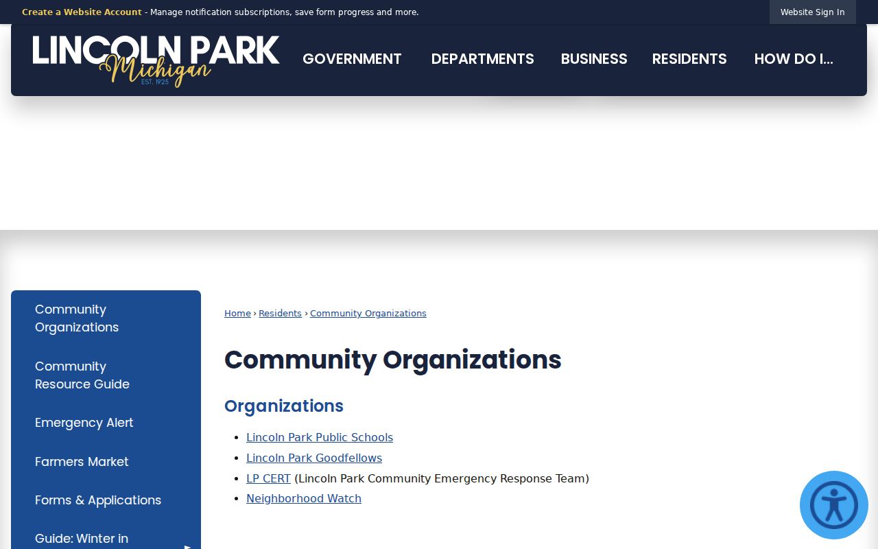
The city’s organization list supplies public routes to community groups without representing their participants as a public household list.
Lincoln Park Civic Group Limits
The city resource guide also identifies the American Legion at 1430 Southfield, the Exchange Club at 1394 Cleophus, and the Fraternal Order of Eagles at 2459 Dix. These names can help a reader locate a civic-history contact or identify where a public event is held. They do not provide a public roster for a nearby parcel. No official citywide neighborhood-association inventory or umbrella registry beyond the city-listed groups and Neighborhood Watch was found.
| Official record category | Commercial neighbor-search category |
|---|---|
| Has a named custodian, defined record purpose, and a source-specific access rule. | May combine public filings, marketing data, directory material, and purchased data with uneven update dates. |
| Can establish a limited fact such as a parcel owner, recorded deed, or civic contact. | Can merge same-name people or repeat old information without showing the original custodian. |
| Allows a focused request or correction through the office that holds the record. | Requires checking the underlying official source before accepting a match as accurate. |
The Chamber of Commerce directory is also limited to business names, categories, and public contact information. It is not a tool for identifying a block’s households. For local community outreach, use a named public organization’s contact route and respect its participation boundaries.
Past Lincoln Park Neighbors
Historical directories can add a time layer to a block. Lincoln Park Public Library holds a combined Lincoln Park, Allen Park, and Melvindale city-directory volume for 1941 through 1988, with missing years. Polk street pages arrange addresses in house-number order and may include an ownership or occupancy marker. Bresser-style reverse directories can organize streets and addresses, identify heads of household, and include phone, first-listed, and relocation notes. Those entries are historical publishing evidence, not a current record.
Use the street section for a selected year, note the target and adjacent addresses, then compare the next available year. A changed name or missing entry can reflect a move, a new structure, a vacancy, an unlisted phone, or a publisher’s indexing choice. The Lincoln Park city directory collections preserve the local holdings and year gaps for a deeper historical search.
Privacy Limits for Lincoln Park Neighbors
A block map is a land and civic-geography tool, not a household list. Public property records do not reliably identify every household member. Utility and delivery customers are not public lists, motor-vehicle information is protected by the Driver Privacy Protection Act, and some court records are sealed or otherwise confidential. Voter copies remove sensitive identity fields. A multi-unit parcel may name an owner or taxpayer without showing occupants by unit.
Michigan’s Address Confidentiality Program, created by 2020 PA 301 and codified at MCL 780.851 et seq., provides qualifying people with a designated substitute address and mail forwarding. ACP information is not subject to ordinary FOIA disclosure. A no-result can be a lawful redaction, an old-index gap, a protected address, or a spelling variation. Ask the relevant custodian how to correct an error rather than reproducing sensitive information.
Lawful use. Lincoln Park neighbors research is for civic curiosity, reconnection, and personal safety awareness. Never use public information to stalk, harass, intimidate, or target anyone.